A municipality, tourism body, rights holder, museum or other responsible organization confirms the relationship.
What the evidence establishes
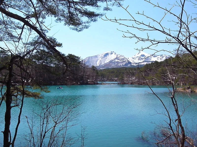
Urabandai’s colored ponds and lakes are interpreted through the volcanic landscape reshaped by Mt Bandai.
This classification is based on Urabandai Tourism Association and Urabandai Tourism Association. The evidence label describes the documented relationship between the story, person, history or cultural practice and the real place.
What the label does not claim
The label is not permission to reproduce copyrighted images, characters, dialogue or logos. It also does not turn every nearby street, building or community account into an officially designated location. Where evidence stops, SceneTrail Japan says so.
Read the place, not only the reference
Kitashiobara makes the geography behind Fukushima’s inland landscapes visible. The 1888 eruption of Mt Bandai transformed valleys and waterways, creating the lakes and ponds that now define Urabandai.
Useful context includes The volcanic landscape created by the 1888 Mt Bandai eruption; Goshikinuma and its changing mineral colors; Lake Hibara, wetlands and highland outdoor culture. These connections matter because they keep the visit rooted in the town rather than reducing it to a photograph or checklist.
Practical starting points
Open the places in visit order
These public places provide a practical route through the town. They are not all claimed as exact scene locations; the evidence statement above defines what is confirmed.
- 01Goshikinuma Pond TrailOpen in Google Maps ↗
- 02Lake Hibara shorelineOpen in Google Maps ↗
- 03Morohashi Museum of Modern ArtOpen in Google Maps ↗
- 04Nakase-numa viewpoint and seasonal trailsOpen in Google Maps ↗
Plan the visit
Use the Tohoku Shinkansen to Koriyama, continue toward Inawashiro, then take a bus to Urabandai. Bus frequency changes by season.
Trailheads and lakeside stops are dispersed. Buses cover the main corridor; a car gives more flexibility, while hikers should plan one-way trail logistics.
Open the complete Kitashiobara guide →
Copyright and conduct
No frame grabs or character artwork are reproduced. Remain on public routes, keep entrances and traffic clear, follow venue photography rules and never enter private land to recreate a shot.
Check live transport and weather notices before departure. Historic sites, shrines, temples and residential streets are shared community spaces: keep voices low, do not enter private property, and follow photography rules. Check closures, bear information and trail conditions; the colored ponds are protected natural features, not swimming areas.
Source register
Sources used for this page
Reconfirm changing information with the responsible organization before travel.
- Urabandai Travel GuideUrabandai Tourism Association · Official tourism organization · checked 22 August 2026
- Urabandai trekking coursesUrabandai Tourism Association · Official tourism organization · checked 22 August 2026