At a glance
independent travelers deciding how to explore Tono’s dispersed folklore sites
Tono, Iwate
9 min read
18 August 2026
Reconfirm changing details with the listed responsible organizations. Source check: 18 August 2026.
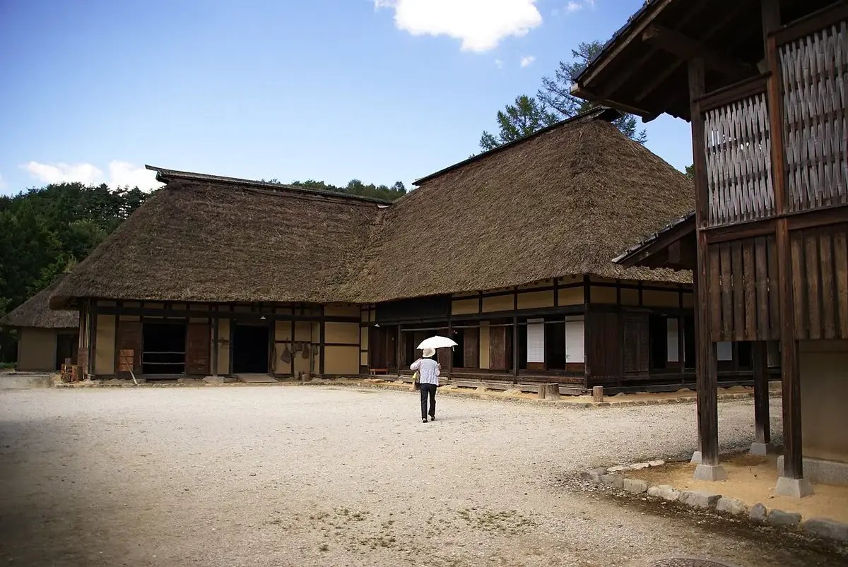
Tono’s folklore sites are spread across a rural basin. The municipal museum and central streets can be visited on foot, but Denshoen, Kappa-buchi, farm landscapes and outer villages require a transport decision. Choosing that transport before arrival is the difference between a coherent journey and a day spent discovering that the next place is several valleys away.
Begin with the evidence in town, then move into the landscape. The stories collected in The Legends of Tono are connected with real communities, beliefs and working land; they are not a license to treat every stream or farmhouse as a supernatural attraction.
Start at the museum
Tono Municipal Museum gives the strongest orientation for folklore, local history and the work of collecting and interpreting stories. Check its current opening information and begin there when possible.
This order matters. Reading the institutional context before visiting rural sites helps distinguish documented tradition from a later tourist retelling. It also gives bad-weather value before committing to an outdoor route.
Use the central area for lunch, supplies and confirmation of rental or bus arrangements. Do not assume a bicycle will be available without checking the current operator and season.
Choose a bicycle when the conditions support it
A bicycle suits travelers who want to feel the distances between town, fields and smaller sites. It works best in suitable weather, with daylight, modest luggage and enough fitness for an actual rural ride.
Before renting, confirm:
- the bicycle type and return time;
- whether advance booking is required;
- helmet, lock and repair support;
- route elevation and road conditions;
- rain, heat and wind;
- where food and water are available.
Do not rely on a map’s visual scale. A loop that looks short may include exposed roads, gradients and few services. Turn back early enough to protect the rental return and train connection.
Choose a car for range, not speed
A car makes dispersed sites and a second landscape area realistic in one day. It does not mean every pin should be added. Rural roads, parking rules and winter conditions still set limits.
Use a car when:
- outer villages or multiple valleys are the main purpose;
- weather makes cycling unsafe;
- the group includes mobility or luggage needs;
- you have confirmed parking at intended stops;
- the driver is comfortable with rural and seasonal conditions.
Never stop on a narrow road for a photograph or enter farm access without permission. In winter, appropriate tires and current road information are essential.
Public transport needs a narrower plan
Travel without a bicycle or car is possible when the itinerary accepts fewer sites. Focus on the museum and town, then use a confirmed bus, taxi or guided program for one rural area.
Check services directly with the responsible operator or the official tourism organization. Seasonal sightseeing transport and community services can change. A taxi quote may cost more than expected but can turn a fragmented day into a reliable half-day circuit.
A coherent folklore route
For many visitors, the best sequence is:
- Tono Municipal Museum and central orientation;
- Denshoen for interpreted rural culture;
- Kappa-buchi as part of the same geographic block;
- one additional landscape stop only if transport and daylight remain comfortable;
- return to town before the final connection becomes the only plan.
Keep the visit grounded in interpretation. Kappa-buchi is a real stream beside community and religious space. Quiet conduct matters more than performing a legend for the camera.
One day or two?
One day works for the museum and one outer cluster. Two days allow a guided folklore program, a broader cycling loop or another valley without racing.
Stay overnight when the stories are the primary reason for travel. Evening and morning in the basin provide a different sense of scale, while local accommodation and food place the cultural material within ordinary life.
Safety and community conduct
- Check rain, heat, snow and daylight.
- Carry water and a charged phone, but do not assume perfect rural reception.
- Keep away from private fields, homes and working farm buildings.
- Ask before photographing people.
- Follow wildlife and bear information.
- Treat shrines, memorials and story locations as community places.
Tono is not difficult because it lacks things to see. It is difficult because the meaning is distributed across distance. A deliberate transport choice makes that distance part of the story rather than a planning failure.
Put the guide on the map
Towns and routes mentioned here
Keep planning
Read next

Chichibu Anime Day Trip
Plan a respectful one-day trip from Tokyo to Chichibu for Anohana, The Anthem of the Heart, Her Blue Sky and the real city around their settings.
Open guide →

Sakaiminato Manga & Yokai Route
Follow Mizuki Shigeru Road from Sakaiminato Station to the museum, then connect the manga trail with the working port and seafood culture.
Open guide →Official sources
- Tono Municipal MuseumTono City · checked 18 August 2026
- Travel TonoTono Tourism Association · checked 18 August 2026